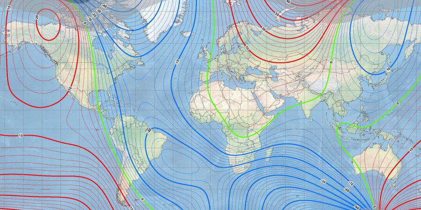
The World Magnetic Model is a critical piece of digital infrastructure that is key to global navigation and corrects a standard compass reading. The WMM provides declination values for all points on Earth, which NGA WMM Program Manager Mike Paniccia explains is the “difference between magnetic north, where your compass points, and geographic north, also known as true north, the fixed point on the top of a spinning globe where all the meridians meet.”

Miller Projection Main Field Declination (D) map from the US/UK World Magnetic Model 2020 (map developed by NOAA/NCEI and CIRES).
February 23, 2024 | Originally published by National Geospatial-Intelligence Agency (NGA) on February 20, 2024

